Sunday, 23 January 2022

Day 244 Jamieson to Mount Terrible

 VIC Day 20 (244) Monday 24th January, 2022

Yesterday whilst sitting around and doing nothing I met Briony and husband Luke. We had a chat about different things including a group paddling the Murray River in support of homeless veterans. Facebook page: THE LONG PADDLE VETERANS OF THE MURRAY.
I mentioned my plan to paddle the Murray River and I'll be looking at their journey. However, Briony and Luke offered to give a lift the 7 or so kilometres to the Poletti Track which will take me up to Mt Terrible and thus back on the trail. I didn't want to make them get up too early so I said I would have breakfast at the store. I also needed to work on the hat to make it wearable with the pack. I had a bit of blue ribbon I picked up around Rumffs Saddle. It still had the balloon attached. I carried it with me since and have now found a use for it. So I get dropped of at the base of the hill and begin the long slow climb. It's a long way up. And of course when you think you've hit a high point there's always another. Just to get up to the Mt Terrible track are 5 false summits.
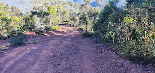
Up We go

False summit more up to do

Mt Terrible Over there

Finally I'm at the Junction. The first thing is you lose 100metrs just so you can do it again. In the saddle is a little Mazda 3 sedan. I take a look and it's been there a couple of days. No plates. Not a spot you'd expect a non 4wd. I get Belinda to ring it through to the police. They already have a report. They need to come up and put a sticker on it.
Abandoned Car

On top of Mt Terrible is a tower. I thought it was just a phone tower but as I get closer you can see its a fire lookout tower with all the aerials on it.
The tower is still up

There's also a nice little hut which has been rebuilt after a fire. It has a water tank so I decide to stop for the night.
The Hut

Behind the hut

A few visitors come through in their cars. Two cars pull up Steph Ethan, Dave and Steve are on a high country tour. Steph has just come from a horse tour that included going from Wonnagatta to Howitt Hut. Not the group I saw but one after. They make me a sandwich and give me a fruit juice popper. Thank you.
The view down to Jamieson

A couple of thunderstorms come through in the afternoon. Only a couple of drops of rain. When the fire watcher from the tower leaves a police car rocks up. I hope he stuck a reported sticker on the car. But they seem to be doing touristy things. They offer me a beer which I decline. Then I'm on my own for the night. I sleep on the bench in the hut. No critters no bugs. Good sleep.
Colours of Sunset


Saturday, 22 January 2022

Day 243 Jamieson


 VIC 19 (243) Sunday 23rd January, 2022

Today was a zero day in Jamieson. However Belinda's mother had notified the ABC program Australia All Over with Macca of my journey and told her to get me to ring in. Bit hard as I needed to be in signal range on a Sunday between 5.30 am and 10 am. I'm also a reluctant speaker so I did let it slide a few times. But today I got up and went down the local phone box and rang in.
I thought there would be some rigmarole to go through but a quick chat to the lady producer and I was on. A note for the unwary is to not ring in just before the news breaks. This limits your time. I had a little more I wanted to say with regards to the trail needing support. I think it needs to develop further to a new age. Bring in the mountain bike people. It's the new thing.
When you see how Thredbo has changed in summer for the mountain bike people you can see the potential. Omeo was building trails to bring them in. A mountain bike trail is much friendlier to horses and humans than some of the tracks that are currently used. The extensive volunteers that work on the Bibbulmun in WA and the Friends of the Heysen Trail in SA all have strategies to boost numbers. I like the end to end groups in South Australia where people join a group and over years complete the Heysen Trail by pooling resources and going out In a group with car pooling and shuffling.
I met a group in Quorn that covered about 100 kilometres of trail in the Flinders but returned each night to the motel. They only carry day packs and get dropped off in a 12 seater bus each day to get picked up the other end. On other sections the people with fewer resources are helped through the multi night process by the others. It means more people who might not be confident on their own can gain experience. Anyway, biggest thing for the National Trail is to get new members. I think families were $80 per year. They had trouble filling all board positions last year. Still a lot of horsey skill there but I'm sure things will change. If you walk/ride parts of the trail register the walk. Insurance is one thing but the Bibbulmun Foundation collects data of people on the trail for funding purposes. I assume this trail is the same.
New Hat

Road to River

The River a Jamieson. Gets very busy

The river bank

Hat modified so not to interfere with the pack


Friday, 21 January 2022

Day 242 Lookout on Lazarini Spur Track to Jamieson

 VIC Day 18 (242) Saturday 22nd January, 2022 21.8km walking

33.8km total
Today is a trip down to Knockwood via the Army Track. There are two river crossings. Of course the track is steep and slippery and I tumble twice. Once breaking my walking stick. I feel unbalanced walking with only one. It's been at least 14 or 15 years since I started using two poles consistently. These poles went to New Guinea with me. The plastic handle is split at the top and I hold it all together with gaffer tape. Which I wear down constantly due to the way I hold them. Also each pole has a section oxidised to the other so I've lost some adjustment. I repaired the broken pole by shortening it just slightly and it works OK so far. But it's a good excuse to modernise and spend money on a new set. I don't trust all mechanisms as I do put a lot of weight on them sometimes. I've had poles collapse before this set.
I'm due to get my last supply bucket down the bottom of the hill at Knockwood. There's a river that runs down towards Jamieson. I'm arguing with myself on what to do about the power and its only when I realise I won't have any photos of the last section of the track I decide to divert into Jamieson and recharge the battery packs. The bucket is hard to find as I hid it well. There were only 4 trees to look behind but I had lain a lot of fallen bark across the top and missed it on the first pass through. I didn't muck about and just through all the stuff into the pack and put the rubbish in the bucket.
Hidden under that

The bucket

I will pick up the bucket on the way back when I've finished. Then it's out on the road and start walking to Jamieson. Now I've driven the road when I put the bucket out and I knew telephone signal started about halfway back but my decision to divert was made from a long view of a map and it didn't look far. I thought about 15 kilometres. Belinda corrected my thinking, as she does, to a more realistic distance of 35 kilometres as it winds with the river. It was hard to walk the road as it reflected the heat and there is this cool looking river on your right just bubbling away. I wondered if my sleeping mat could hold my weight with pack and I just float. I walked past families camped and people fishing and just dribbled sweat.
I don't normally thumb a lift. If someone stops and offers I might accept. But after I had lunch I was still a long way so I decided to actively ask for a lift. After about 5 cars a lovely gentleman, Lyndon, stopped and offered me a ride. Very much appreciated. Couldn't buy him a coffee as he and his wife were due elsewhere.
As a bonus the general store makes good coffee and had Pepsi Max. One downer is, I left my hat in the car. Jamieson was full but Belinda had spoken to the caravan park and they offered me a patch of grass for $20 a night. Again, very much appreciated. They also let me plug the battery packs in the office overnight so they charged and I didn't have to hang about. Went to the pub and had dinner bought a bottle of Merlot and sat under my tree and caught up with the diary. Some drunks down the river woke me up about 2am but they soon tired and went. Now to rest my legs for the final push
Zippers not working


Thursday, 20 January 2022

Day 241 Shillinglaw Creek to Lookout on Lazarini Spur Track

 VIC Day 17 (241) Friday 21st January, 2022 34.4km

The sleep was pleasant. Some plant I've crushed under the tent has a Herby type scent. The leaves look like sage but much sweeter smell.
Onwards
The walk today continues on a road and climbs but with the gradient at a reasonable slope the walk is quick. I get to an intersection where the AAWT comes back in. I sort of regret not taking the AAWT to this point. There's a water point here, which is atype of dam according to notes but I couldn't be bothered pushing through weeds to check it out. The road continues through along a cutting in the side of the Ridge to a spot called Rumffs Saddle. Then there's a steep climb up Barkley Jeep track to the Licola Road. There's a sign warning the 4wdrivers that the track is badly damaged and don't use. Other people have written on the sign as well. Goes to show even 4wdrivers will give up eventually.
As I climb I can see why the warnings. But it is the drivers who cause the damage that exacerbates with rain. It's is a hard slog but hopefully one day it can be repaired to a walk track. The march flies have found me and are my constant companions. Annoying when they find a spot and I slap at them only to miss and stumble on the rocks. It's a relief to get up top onto the road and pick up pace and with a little breeze they become manageable. The turn off to Lazarini Spur is made but I'm not hopeful of water.
They mention a spring down the road and I go down to check it out. There are signs mentioning log trucks and a few cars come out as I walk the road. The spring is a damp patch . I decide to go further to what looks like creeks further down the road.
The notice


It's early afternoon when I then come across a logging notice saying the spur road is in the safety zone for about 8 kilometres. I decide to walk through before morning as it looks like people have packed up.
On one bend there is a beautiful clear creek running under the road. I fill up with water then I just have to walk out the logging zone and find a spot for the night. This proved to be a long walk up and over steep little hills until I finally came to a lookout that had some room and no large trees to worry about.
View from the Lookout

The Solar panel is not charging anything smart. Looks like a controller within the electronics has blown. It will charge the inreach. It charged 7 or 8 seconds then goes off for 14 seconds. This just repeats. The inreach seems to be able to handle it and over a couple of hours takes in a charge. It's like a capacitor charging and discharging but with one or two more blown or a controller to smooth the discharge cycle not working. The phone is nearly dead. It's getting hot and I'm glad of the elevation and a breeze.
I set up the tent on the left.


Wednesday, 19 January 2022

Day 240 Black Soil Gully Track to Shillinglaw Creek

 VIC Day 16 (240) Thursday 20th January, 2022 16.8km

5009.7 / 222.2km
As I went a little further than planned today could have been a short day. But first I have to climb a hill then lose all the elevation on the other side. Typical day really.
The track straight up lookout hill
The hill is called Mt Lookout. Unless the track goes to the top I'm not. Halfway up a bloke in a Ute drives up. The road is rough and I can hear his stuff bouncing around from a long way off. He stops for a chat. He has spent a couple of days higher up but the fog hasn't helped him hunt. So he's moving further down to pick up some meat and then will go home.
We talk about some noises I heard this morning . A honking type noise. He said it is deer when they get your scent. As I'm talking to him I notice his left hand shaking and he seemed nervous. Maybe just not good at conversation but the stories about the couple at Wonnangatta and burnt bodies at Grant...as he drives off my mind starts wandering. He obviously has a rifle.
I start walking on the inside edge of each turn as I climb. Looking for an escape path. Should I go down or up the hill. It's the first time my thoughts have gone dark. In the end the climb is to strenuous and I stop caring.
Then back down again

The road does not go up Mt Lookout and I don't bother to take the side road. Once I'm at the top it's time to go down. But I stop and check my map. This can't be right. A road well travelled, in good repair and at a gradient a 2wd car could handle. But yes it is. Victorians do know a little about road building and they have heard of switchbacks . I manage the 8 kilometre descent to Rumffs Flat without falling over or painful knees. But then I hit the camping areas.
The road is civilised in its gradient

A switchback

Shazza and Dazza have been here. Rubbish and excrement not conducive to my mental health so I climb the road out of Rumffs Flat.

Looks Ok as you walk in.

Till you see the rubbish. Ill spare you the toilet

I have a choice, climb over 1000 metres in 7 kilometres with the first 500 in 600 metres or do the same at a gentle 20 kilometres. I choose the long way. All I'm looking for is water and a clean flat spot and 6 kilometres later I come across Shillinglaw Creek crossing the road. Beautiful cool clear water with a shade relatively flat spot under a tree. Ahhh bliss.
My Camp spot

I bathe and wash and drink tea and act civilised. I do it all without leaving behind rubbish or dirtying the creek water or the bush.


Tuesday, 18 January 2022

Day 239 Pine Creek to Black Soil Gully Track

 VIC Day 15 (239) Wednesday 19th January, 2022 21.6km

Early start again today. It's one of those steep days going down to the Macalister River.
The Morning Road
I've worked out it's the steep downhill that causes my right hip joint to ache. This is on top of the lump that is sore. On the Heysen I thought I had damaged the joint but an ultrasound showed it to be Bursitis, which is the lubricating sack being aggravated. A cortisone injection fixed it. I've walked all this way and haven't had any trouble till these steep declines here. Hope it doesn't flare up badly as by the time I finished the Heysen I couldn't sleep on my right side.
Going Down There

Slippery Gravel

Caledonia River Valley

Hitting the Macalister I then have to do 5 or 6 river crossings. No real problems as I find shallow rock hops on all the crossings. So no boots off.
Reminded me of the natural bridge in Albany WA. Hope it stands up to the erosion and forms a bridge.

The berry vine chocking the river edges

The designated camp site is across the river where the Caledonia River joins. I get across both but am not real happy with the camp spot. 30 metre tall widow makers all round and a wind blowing.

Not too hard river crossings. Lovely clear water.

Macalister and Caledonia River Junction.

Belinda has a quick look at the satellite view to see if mentioned grassy areas are any good. Bit hard but she can see open areas. I take a chance and load up with my 3 litres of water and begin the climb out of the river side. The mentioned grassy areas are not to my liking and I have to keep walking.
In the end I only have to walk 4 kilometres to where there is a track intersection that has a flat open area with no overhanging trees. The one has fallen already and has been sawn for firewood.

Camp spot
The zippers on the tent are starting to play up now. I must have kicked a brown dog somewhere. So far it's an easy over come with me just holding my tongue just right and slowly zippering up. If it doesn't mesh I back up and change the position of my tongue and go again. Painful when I need to pee in the middle of the night. Today I'm sure the Solar panel drained my battery pack instead of charged. I now turn off my phone altogether to save charge. The Inreach lasts about 3 days and I need to make sure I have charge for that.

Day 238 Howitt high plains to Pine Creek

 VIC Day 14 (238) Tuesday 18th January, 2022 26.7km

4975.1 / 256.8km
I leave Howitt Hut camp early. I feel well rested and as I walk out I only see one person moving about from the horse group. It is foggy but the initial part of the walk is fairly flat.
The Howitt Road
I notice in the fog my beard catches moisture. I wonder how much I can drink if U suck on it a lot? Tried it once.
Howitt High Plains
By breakfast I'm still pretty much in fog. The track is getting rougher as I go down the Butcher Country Track. So named apparently as the cattle duffers would butcher the cattle they stole and transport the meat this way to various mines.
My Breakfast Spot
Still Misty

The colours of the tree

Butcher Country Track

The day is unremarkable as we stay up high. The camp spot is where Pine Creek starts but up here and this side of the range it's a little dry and the water at the head has stopped flowing. I do follow a trickle into the bush and come across a silty puddle with just a small inflow. Enough for me to dig a hole in the mud and let it flow clean then dropping my water bag in the hole and just skimming the flowing clean water. It takes a while to fill the bag then I filter it into a clean water bag. Because I left my 3 litre bag down Dry Creek I can only collect 1 litre at a time. Takes a while but I get enough for night camp.
Looking over Caledonia River Valley

There are cleared grassy spots here and I'm setting up the tent and some of my mesh tears at the stress points. I wonder what I have done wrong for all this to start happening in the last week. I repair what I can with gaffer tape and Fixomoll. I
just need to keep the bugs out.
The repairs. These are the stress tears in the mesh


Day 250 Mondo Yards to Donnellys Weir (Healesville)

  VIC Day 26 (250) Sunday 30th January, 2022 18.5km 5330km I slept like a log. I can remember falling asleep as I was typing my diary. Wasn...