Thursday, 20 January 2022

Day 241 Shillinglaw Creek to Lookout on Lazarini Spur Track

 VIC Day 17 (241) Friday 21st January, 2022 34.4km

The sleep was pleasant. Some plant I've crushed under the tent has a Herby type scent. The leaves look like sage but much sweeter smell.
Onwards
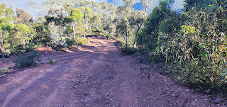
The walk today continues on a road and climbs but with the gradient at a reasonable slope the walk is quick. I get to an intersection where the AAWT comes back in. I sort of regret not taking the AAWT to this point. There's a water point here, which is atype of dam according to notes but I couldn't be bothered pushing through weeds to check it out. The road continues through along a cutting in the side of the Ridge to a spot called Rumffs Saddle. Then there's a steep climb up Barkley Jeep track to the Licola Road. There's a sign warning the 4wdrivers that the track is badly damaged and don't use. Other people have written on the sign as well. Goes to show even 4wdrivers will give up eventually.
As I climb I can see why the warnings. But it is the drivers who cause the damage that exacerbates with rain. It's is a hard slog but hopefully one day it can be repaired to a walk track. The march flies have found me and are my constant companions. Annoying when they find a spot and I slap at them only to miss and stumble on the rocks. It's a relief to get up top onto the road and pick up pace and with a little breeze they become manageable. The turn off to Lazarini Spur is made but I'm not hopeful of water.
They mention a spring down the road and I go down to check it out. There are signs mentioning log trucks and a few cars come out as I walk the road. The spring is a damp patch . I decide to go further to what looks like creeks further down the road.
The notice


It's early afternoon when I then come across a logging notice saying the spur road is in the safety zone for about 8 kilometres. I decide to walk through before morning as it looks like people have packed up.
On one bend there is a beautiful clear creek running under the road. I fill up with water then I just have to walk out the logging zone and find a spot for the night. This proved to be a long walk up and over steep little hills until I finally came to a lookout that had some room and no large trees to worry about.
View from the Lookout

The Solar panel is not charging anything smart. Looks like a controller within the electronics has blown. It will charge the inreach. It charged 7 or 8 seconds then goes off for 14 seconds. This just repeats. The inreach seems to be able to handle it and over a couple of hours takes in a charge. It's like a capacitor charging and discharging but with one or two more blown or a controller to smooth the discharge cycle not working. The phone is nearly dead. It's getting hot and I'm glad of the elevation and a breeze.
I set up the tent on the left.


Wednesday, 19 January 2022

Day 240 Black Soil Gully Track to Shillinglaw Creek

 VIC Day 16 (240) Thursday 20th January, 2022 16.8km

5009.7 / 222.2km
As I went a little further than planned today could have been a short day. But first I have to climb a hill then lose all the elevation on the other side. Typical day really.
The track straight up lookout hill
The hill is called Mt Lookout. Unless the track goes to the top I'm not. Halfway up a bloke in a Ute drives up. The road is rough and I can hear his stuff bouncing around from a long way off. He stops for a chat. He has spent a couple of days higher up but the fog hasn't helped him hunt. So he's moving further down to pick up some meat and then will go home.
We talk about some noises I heard this morning . A honking type noise. He said it is deer when they get your scent. As I'm talking to him I notice his left hand shaking and he seemed nervous. Maybe just not good at conversation but the stories about the couple at Wonnangatta and burnt bodies at Grant...as he drives off my mind starts wandering. He obviously has a rifle.
I start walking on the inside edge of each turn as I climb. Looking for an escape path. Should I go down or up the hill. It's the first time my thoughts have gone dark. In the end the climb is to strenuous and I stop caring.
Then back down again

The road does not go up Mt Lookout and I don't bother to take the side road. Once I'm at the top it's time to go down. But I stop and check my map. This can't be right. A road well travelled, in good repair and at a gradient a 2wd car could handle. But yes it is. Victorians do know a little about road building and they have heard of switchbacks . I manage the 8 kilometre descent to Rumffs Flat without falling over or painful knees. But then I hit the camping areas.
The road is civilised in its gradient

A switchback

Shazza and Dazza have been here. Rubbish and excrement not conducive to my mental health so I climb the road out of Rumffs Flat.

Looks Ok as you walk in.

Till you see the rubbish. Ill spare you the toilet

I have a choice, climb over 1000 metres in 7 kilometres with the first 500 in 600 metres or do the same at a gentle 20 kilometres. I choose the long way. All I'm looking for is water and a clean flat spot and 6 kilometres later I come across Shillinglaw Creek crossing the road. Beautiful cool clear water with a shade relatively flat spot under a tree. Ahhh bliss.
My Camp spot

I bathe and wash and drink tea and act civilised. I do it all without leaving behind rubbish or dirtying the creek water or the bush.


Tuesday, 18 January 2022

Day 239 Pine Creek to Black Soil Gully Track

 VIC Day 15 (239) Wednesday 19th January, 2022 21.6km

Early start again today. It's one of those steep days going down to the Macalister River.
The Morning Road
I've worked out it's the steep downhill that causes my right hip joint to ache. This is on top of the lump that is sore. On the Heysen I thought I had damaged the joint but an ultrasound showed it to be Bursitis, which is the lubricating sack being aggravated. A cortisone injection fixed it. I've walked all this way and haven't had any trouble till these steep declines here. Hope it doesn't flare up badly as by the time I finished the Heysen I couldn't sleep on my right side.
Going Down There

Slippery Gravel

Caledonia River Valley

Hitting the Macalister I then have to do 5 or 6 river crossings. No real problems as I find shallow rock hops on all the crossings. So no boots off.
Reminded me of the natural bridge in Albany WA. Hope it stands up to the erosion and forms a bridge.

The berry vine chocking the river edges

The designated camp site is across the river where the Caledonia River joins. I get across both but am not real happy with the camp spot. 30 metre tall widow makers all round and a wind blowing.

Not too hard river crossings. Lovely clear water.

Macalister and Caledonia River Junction.

Belinda has a quick look at the satellite view to see if mentioned grassy areas are any good. Bit hard but she can see open areas. I take a chance and load up with my 3 litres of water and begin the climb out of the river side. The mentioned grassy areas are not to my liking and I have to keep walking.
In the end I only have to walk 4 kilometres to where there is a track intersection that has a flat open area with no overhanging trees. The one has fallen already and has been sawn for firewood.

Camp spot
The zippers on the tent are starting to play up now. I must have kicked a brown dog somewhere. So far it's an easy over come with me just holding my tongue just right and slowly zippering up. If it doesn't mesh I back up and change the position of my tongue and go again. Painful when I need to pee in the middle of the night. Today I'm sure the Solar panel drained my battery pack instead of charged. I now turn off my phone altogether to save charge. The Inreach lasts about 3 days and I need to make sure I have charge for that.

Day 238 Howitt high plains to Pine Creek

 VIC Day 14 (238) Tuesday 18th January, 2022 26.7km

4975.1 / 256.8km
I leave Howitt Hut camp early. I feel well rested and as I walk out I only see one person moving about from the horse group. It is foggy but the initial part of the walk is fairly flat.
The Howitt Road
I notice in the fog my beard catches moisture. I wonder how much I can drink if U suck on it a lot? Tried it once.
Howitt High Plains
By breakfast I'm still pretty much in fog. The track is getting rougher as I go down the Butcher Country Track. So named apparently as the cattle duffers would butcher the cattle they stole and transport the meat this way to various mines.
My Breakfast Spot
Still Misty

The colours of the tree

Butcher Country Track

The day is unremarkable as we stay up high. The camp spot is where Pine Creek starts but up here and this side of the range it's a little dry and the water at the head has stopped flowing. I do follow a trickle into the bush and come across a silty puddle with just a small inflow. Enough for me to dig a hole in the mud and let it flow clean then dropping my water bag in the hole and just skimming the flowing clean water. It takes a while to fill the bag then I filter it into a clean water bag. Because I left my 3 litre bag down Dry Creek I can only collect 1 litre at a time. Takes a while but I get enough for night camp.
Looking over Caledonia River Valley

There are cleared grassy spots here and I'm setting up the tent and some of my mesh tears at the stress points. I wonder what I have done wrong for all this to start happening in the last week. I repair what I can with gaffer tape and Fixomoll. I
just need to keep the bugs out.
The repairs. These are the stress tears in the mesh


Sunday, 16 January 2022

Day 237 Zero day at Howitt High Plains Camp

 Vic Day 13 (237) Monday 17th January, 2022

Zero day at Howitt High Plains Camp
The dead wood is artistic

The horse group arrived

My setup for the day


All reactions:
Karen Coughlan, Debbie Simpson and 26 others

Saturday, 15 January 2022

Day 236 Wonangatta Station to Howitt Plains

 VIC Day 12 (236) Sunday 16th January, 2022 18.6km

4948.7 / 283.2km
Today is not a big day. I'm heading back up the range to my food bucket at Howitt Plains. Depending on how much food I have I might stop for a rest day. My legs are getting wobbly on these ups and downs. My day starts early and I pass through Wonnangatta Campsite proper after about 3 kilometres
A horse tour group

. Everyone is still in bed. There is one large group that look like a horse group by the logo on the 4wd. I did see a sign for a horse paddock but didn't see horses.
Woonagatta Station

I pass the old homestead site then move on and divert up to an old cemetery. The story tells a hard life with the Smith's leaving when the wife giving birth to twins died and the twins died 3 weeks later. The father and sons then left the property. The Bryce's were here a while but Annie Bryce lost her 3 year old daughter then her oldest daughter who had lived here for 17 years died at 21. Annie Bryce was the last person buried here in 1914 as she wanted to be with her daughters. Sad stories. I feel blessed to have 3 grown and healthy children. I would never really want to outlive them.
Cemetery at Wonnagatta. Sad

The trail turns up a two wheel track that disintegrates into mud holes the 4wdrivers have churned through. I think it's going to be a long day but after a kilometre or two even they give the track away and the trail descends into an old overgrown wagon track.
Dry river track

Old creek crossing. wood

The horse group has come down this way and I can easily follow the crushed grass. It then a couple of crossings of the Dry River which thankfully is not dry and then the trail turns into a animal track recently walked by the horse group. Easily followed and zig zagging its way up 1000 metres over the next 7 kilometres.
Looks like a camp spot

Track deteriorates but a NT sign points the way 

I stop to filter some water for the climb and when I leave I've left behind my 3 litre CNOC bag. Somewhere during the day I've also lost one of my Adidas camp slip ons. All this way and I lose two things in one day. Of course I note this when I camp and I'm not going back down the 1000 metres to find them.
Up Top

I get up top and it's the most pleasant walk I've had so far in Victoria. The path is a horse pad and of course they've zig zagged their way down. Churned the track a bit as it's a little damp and as they come back up later the following day I see there are about 20 of them in total. The group is from Mansfield. They have left some gear like a trailer and some tarps so that gives me good idea where to plonk my tent well out of the way.
The bucket.

I find the bucket undisturbed and cart it down to Howitt Hutt and work out I'm zeroing here tomorrow. It's good just to sit rehydrate rest the legs and eat the excess food. Every stop I've been setting up the Solar panel in the ultimate capture position and its not making much difference to generating enough power. I'm getting worried as the next town is still 9 or 10 days away. I turn off the phone and photos are short as I only turn it on occasionally.


Day 250 Mondo Yards to Donnellys Weir (Healesville)

  VIC Day 26 (250) Sunday 30th January, 2022 18.5km 5330km I slept like a log. I can remember falling asleep as I was typing my diary. Wasn...