Saturday, 15 January 2022

Day 235 Cynthia Range Track t Wonangatta Statiom

 VIC Day 11 ( 235) Saturday 15th January, 2022 24.8km

Today was a long arsed day starting with one of those steep downhills that are taxing and dangerous to an old fart like me. Victoria is becoming my least favourite section.
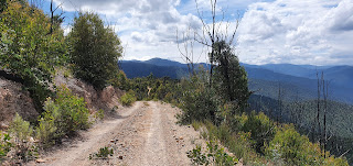
Whilst Qld has a lot of road walking all of Victoria is as well, but the roads are 4wd roads that no sane walker or horse would love. Mountain bikes couldn't ride up some of these hills and only those mad downhill riders (thinking Ben McGrath) would ride down them
After dropping down the road, it was a pleasant walk

Still up high though

Anyway a long day getting over and down, I assume the Cynthia Range to then tackle 3 crossings of the Humffray River.
Here we go

Down down again

These are about upper thigh deep. The waters are fast and a little muddy but with skinny legs and poles I go ok.
One crossing of Wonnangatta River

The last river crossing is the Wonnangatta River which is clear water and rocky bottom about knee deep at most.
Wonnangatta River

I then manage about 6 kilometres more before I give it away and setup camp. I wash my clothes in the river water and have a bath. It's a lot warmer down in the valleys and the March flies and normal little black ones are becoming more prevalent. The fly net comes out more often now and it makes it hotter on the face but better than those little black bastards that hover and then dart straight in to the eyeball. Lots of sun today so there is definitely something wrong with solar panel.


Thursday, 13 January 2022

Day 234 Talbottville to Cynthia Range Track

 Vic Day 10 (234) Friday 14th January, 2022 16.8km

I read the information board at Talbotville and attached was a little card say McAllister or McMillan was responsible for general massacres of the Aboriginal people around the area. The names are celebrated throughout the district and I wonder at the veracity of the information or do we just ignore this older history.
1st Creek Crossing

I'm having trouble with my solar panels. It doesn't seem to be generating
power and with overcast days I'm losing power all the time. I have to turn off the phone more often and photos become less. I have a clear day today so will check it out later. The trail does a 9 kilometre meander and I see the signs for the McMillan track that ends at the Pioneer Racecource but about 7 kilometre shorter with only the one river crossing. I decide to give it a go but it is not a maintained track and a couple of hundred metres short I'm bleeding from the overgrown Berry vines and have to turn back. Then it's a 2 hour walk around the original trail. Oh well. A lot of betadine on the scratches and start again.
Looking down from McMillan walking track

Makes me think though how much affect we've had on this country in the short
time we've been here. I'm wandering on roads and tracks. I don't know what it would be like through Virgin bush but it would have been a lot easier without blackberry vines infesting our waterways. I have to do 3 crossings of Brewery Creek and 1 crossing of Wongangurra River.

Wongungarra River

I meet a convoy of 4wds going to Dargo. The pub was going to reopen on the 14th, I don't know whether it did? I get round to Station Track, then comes the ordeal of climbing one of these ridiculously steep hills. It takes a few goes and the only consolation is it gets cooler by a bit as I go up.
River Crossing Number 3

The other problem was I had a full load of water as I can't work out where
the next puddle will be on top of the Ridge line. I sit down to have a rest and a convoy of 8 comes up the hill going back to their camp at Eaglevale. These 4wds love this country. Horses, mountain bikers and hikers not so much, or not these gravel roads. We have a chat as they pass. If they had come an hour earlier they could have least taken my pack to the top. But that's not the end of this torture. The road roller coasters its way to Mount Cynthia.
Private Property

Hill Climb
Road across the top

Looking back down the valley

I'm looking at some dark clouds rolling towards me and ask Belinda to check
the weather. A severe thunderstorm warning is in place for here. I find a spot on the track and setup the tent. There was a flat spot just off the track but that turned out to be the toilet. None of it buried of course. It's while I'm here looking at the view with the toilet paper and beer cans I dream up Shazza and Dazza.
I can just picture Dazza driving his old modified Nissan Patrol, mainly
because he couldn't afford a decent Toyota. Belching smoke and gravel as he tears the track apart as fast is better. He pulls up top and jumps out with a Carlton Dry (it seems up here) in one hand then his dick in his other as he belches while Shazza squats on the other side of the car. Dazza says, "love this view Shazza". "Yeh", says Shazza."How far to Dargo Dazza?". "About a 6 pack Shazza. How many cartons of beer did we pack for the weekend Shaz". "3 love". "Hope it's enough Shaz. Be a shit weekend if we run out. Ready Shaz?" "Yeh Daz" as she delicately places a rock to hold her toilet paper down.(For the Pixies presumably). The can gets a quick crush and is dropped beside the road as another tin is cracked open and the patrol belches more diesel fumes and tears a bit of gravel up,(maybe not if it's a Nissan) and they disappear. And thus it explains what I see when I get to the top of Mount Cynthia.
The track drops. Never seems to be a gentle slope.
The storm moves overhead and I sit it out in the tent. I'm far enough from
the edge to miss most of the wind. The bonus is I collect rainwater as it runs off the tent. The storm passes before it's dark but I stay where I'm at and spend the night.

Wednesday, 12 January 2022

Day 233 Dogs Grave to Talbottville

 VIC Day 9 (233) Thursday 13th January, 2022 76.9km with diversion

Early start for the long walk. The day would normally be about 31 k but with diversion down Jones road to get a bridge across the Dargo River it will take about 43 kilometres to get to the same spot.
Sunrise

The road heading down

Clouds down there
The day again is unremarkable just walking along Birregun Road. I pass the trail turnoff down Stock Route Sour Track and are seriously tempted to try my luck with the river crossing but the steep hill puts me off as it's a 1000 metre drop in height over 3.5 kilometres and I'm not willing to climb back up.
Drop off to Dargo River
So I keep plodding along. I had a joke with Belinda that if a car came along I would offer them a beer to get me down to Dargo Pub. But the Pub had shut down and I had passed two road closed sign but didn't expect to see any cars.
I was sitting down eating lunch when a car did pull up. Nick had talked to a council worker and had gone up the Upper Livingstone Road but had missed the second notice at the State Forest Boundary about the Jones Road Closure. We had a chat and since I had a photo of the diversion we decided he would give me a lift down to Dargo via the vehicle diversion. I think the whole diversion added about 60 kilometres. In the end he would have been fine as they did have detour signs at the track intersections and end up coming into Dargo from the south. It saved me the 6 kilometre walk down Jones Road.
In Dargo the pub and the Inn were shut but I picked up a coffee. We headed back up to the trail on the Upper Dargo Road and after having a discussion, Nick took me over the Dargo High Plains Road and showed me around Grant then took me on to Talbotville. A bit of a cheat for me. Half of it was Bitumen road to Grant which looked like it was ready to fall into the valley with the bitumen sagging dramatically for about a third of the width.
Nick also offered me a beer and we sat and talked about plans we have. I've invited him home when he visits Perth. Hope everyone I've invited don't all roll up together. Then I get some Vegemite and corn thins from him. Cheese would have made the ideal snack but corn thins and Vegemite are a good combination anyway. Puts a different smell in the tent at night though.
Grant

Brewery Creek

Fruit Trees at Talbotville

My Company
I set up beside Brewery Creek and contemplate staying an extra day as I've bypassed a days walk. Although I've added half the distance doing part of the diversion. We have cows for company so that lovely cow poo smell I'm used to returns. There are also fruit trees and I think it's a plum is in fruit though they are cherry tomato size. I have a few. There's also a fig that is going to heavy in ripe fruit soon. There are 4 camping groups including me along the river and I can see it would be very popular.
Camp at Talbotville


Day 232 Birregun Road to Dogs Grave

 VIC Day 8 (Day 232) Wednesday 12 January, 2022 17.5km

4812.1 / 401.3km
Today was a simple 17.5k walk to a camp site called Dogs Grave. All along Birregun Road. There was a bit of fog. The walk was mainly uneventful. There were showers on and off and I got to the campsite by about lunch time.
The start off

Climbing the Range


Road into Dogs Grave
It was a surprise to see a hut here. Put up by the Australian Deerhunters Association. Well built hut and no holes for critters and birds to get in. The inside walls are graffitied with signatures of visitors. I found Sasha's under Tegan and Tom's another couple I followed who rode the trail north in 2017. I think they went on to the top of Cape York. I added my signature to this area to keep the Trail bits altogether. Added a note to say Sascha had completed the journey. She would have only been on trail less than a month. Full of enthusiasm. I'm getting a little jaded though.
The Deer Hunters Hut

The National Trail Signatures

Dogs Grave is named because another drifter buried his faithful hound here in 1863. I set up the tent mesh in the hut and tried to dry stuff out with showers coming across every so often. A couple spending the weekend camping came down to the Grave and we ended having a brew together. He is an army man transferred to Bandyanna. I thought that was artillery in my day. He was born the year I joined and has been serving 20 years. Makes me feel old now. Spent a quiet restful night in the hut. A long walk tomorrow with a 12 or 15k diversion.


The Dogs Grave


Tuesday, 11 January 2022

Day 231 Omeo to Birregun Road

 VIC Day 7 (Day 231) Tuesday 11th January, 2022 15.8km

4793.5 / 419.9km
Got out of bed keen to go. Not a big day and maybe a breakfast on the way out. Then I look out the window, it's pouring rain.
The Day Looks wet

The pub puts on a continental breakfast so I go down and have a coffee, cereal and toast and just look out the window. I was thinking of calling the day off but looking at the radar there was a break due around 11am.
My view from breakfast
I decided to walk downtown and get a coffee and see what happens. After an hour I need to either buy more stuff or just suck it up and move. In the end I leave Omeo in drizzling rain. At least it's not heavy and likely to cause massive creek rises like a week ago. You could see the Livingstone Creek level at about a metre and a bit higher and machines were down repairing the damage in the riverside park.
Livingstone Creek. You can see the flood level.

I was at least heading for the hills again. When I get to turn off the bitumen road into Upper Livingstone Road there's a road closed sign.
A few quick messages via Belinda and the council just says there's been some washaways but walking through is OK.
I was given the OK

One floodway to negotiate then a simple walk to the camp site. However on this corner there's another road closed sign saying the road I've been asked to detour down further up to bypass trying to cross a flooded Dargo River is also closed due to a landslide.

No Access to Dargo??

I took a photo of the detour

More messaging and it appears walkers, horses and motorbikes can still get through. So a wet set up and another short day planned as I climb the range.
An old wreck


Monday, 10 January 2022

Day 229 + 230 Omeo

 Vic Day 5 and 6 (229 & 230) Sunday 9th and Monday 10th January, 2022 Zero Days

4796.5 / 416.9km
This is my last stop before a 3 week walk to the next town of Marysville. I need to make sure I got everything ready. The next walk goes close to the Dargo Pub and I plan a diversion for some Pub grub. Then I get the message the Dargo has closed due to a close contact Covid case. At this stage its closed till the 14th January. I can wangle getting there on that date. Disappointing as the next section to Howitt Hut is 7 or 8 days and the Dargo was a break in there.
It means I have to pack as if I don't get a meal. Omeo has good food and cafes so I enjoy the break before the final push.
Omeo also has a laundromat. I go down to wash and meet Monica. We all need a Monica in our life(Mambo No 5). Feisty 80 year old. Little bit saucy as well. There's only one machine working and Monica hooks me up with Jeffo, a bus driver from Sydney on two week holiday camping in the Alps and visiting friends.
We become undie brothers where our filthy undies mingle in the washing machine and dryer. They smell a lot better with a dash of Dynamo from Monica. We all have a good talk and a laugh.
Laundromats are a good place to talk as are campsites. I've had dinners in both pubs and will pick up a breakfast in a Cafe before leaving tomorrow. Some damage down by the river and its a shame to see the caravan park shut. One of my dinners was planned down at the Red van in the park. I think I'm ready for the final push. Next stop Marysville 3 weeks away then hopefully a 1 day walk over the hill to Healesville. Just the steep hills in the way. I expect to whinge a bit yet.
The Hotel

Getting the chocolate stash

The road into town


Saturday, 8 January 2022

Day 228 Native Cat track to Omeo

 VIC Day 4 (228) Saturday 8th January, 2022 50.2km

24.7 walking
The night is restless and the spot I've setup isn't ideal. I think I've got an animal living close and I worry most of the night it may chew its way in. Light showers over night and I'm ready to put in a big day if I can.
The Morning Road

I get a message to say the Omeo Caravan Park has closed permanently as they have suffered their 4th flood. and Tambo River has a flood watch. As I'm walking I'm trying to work out a route. The plan is to try and get down to Bindi Station which is on the Tambo River. There are two ways. One is 25 kilometres across a fairly steep track the other is 12 kilometres longer.
Tambo River South

I don't decide until I get to the turnoff down Garron Point Track which is the shorter steeper route. I do have to cross Tambo River South. I see a couple of cars have come up so I go the short steep way.
The track down to the river is very steep and slippery. I hope I can get across the river. It's going to be a bugger going back up. I can hear the river when I get close and I get a little worried. But when I see it I think it's definitely doable. As long as the depth is OK. I check both sides of the actual track crossing and there are a couple of spots upstream and downstream that look OK. But I decide to wade across the track crossing. The poles check the depth and help me brace the current. The depth is mostly just above knee height but there was a hole just before the exit at ball deep that I slipped into. Didn't really worry me and I stopped and had breakfast before moving on.
One of the drop offs. I was hoping it would be the last

I get to an intersection of the Marble Gully Track and get a message to say don't go to Bindi as they are flooded in with Bindi Creek and Tambo River flooding. Bit late as I'm only 12 kilometres away. To now turn back would involve getting back to a road and going round the Tambo River to Omeo. However once Penny and Fraser from Bindi Station hear where I am they say to keep coming and as long as I can get across the creeks to the homestead then they will give me a lift into Omeo.
Looking down on Bindi Station

So I continue on up and down some steep hills to the back end of Bindi Station. Then it's a walk across their paddocks and a long jump across one creek.
A diversion around a large bull then a boots off wade across Bindi Creek. It started raining as I was crossing the paddocks. No photos in the rain, then I met Penny and Fraser who loaded me in the Ute and drive me into Omeo. Penny drops me off at the Hilltop Hotel the only spot in town with room available. It's raining. Do I attract the rain. From the day I started it seems everyone is having their wettest periods. I'm in Omeo a day early so I intend to stay 3 nights. Hopefully some of the creeks and rivers go down.
A memorial to men killed in 1868. John Jones 32,William Dale 35, Thomas Morley a Shepherd
 aged 35. "These men have no known relatives. They came from the British Isles in search of a better life in a new country.".


Day 250 Mondo Yards to Donnellys Weir (Healesville)

  VIC Day 26 (250) Sunday 30th January, 2022 18.5km 5330km I slept like a log. I can remember falling asleep as I was typing my diary. Wasn...