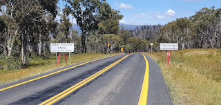
Wednesday, 29 December 2021

Day 218 Grey Mare Hut to Consett Stephens Pass 22.3 km


 NSW Day 76 (218) Wednesday 29th December, 2021 22.3km

4409.3 / 689.6 km
I get up with the tent fly frozen.

Tent Frozen
This is where I pack up as much as I can before handling the outside work. Definitely do my shirt cuff buttons up before my fingers freeze up.
Geehi River Valley

Long Shadow In the Morning


There are people camped at Grey Mare Hut.
Geehi River


I'm glad I stopped early. The trail then heads down to Valentine Hut. When I get there it is very brightly painted. Pink I think.


Valentines Hut


Then pass another large hut called Schlink which then goes over the Schlink Pass at 1804 metres.
The track drops a little down to Whites River Hut and this is where I turn off the formed track and head up across the watershed of the Great Divide and climb on unformed tracks to 1900m.

White River Hut
This is where there are still patches of ice melting mostly on the eastern slopes. After finding my way through the Granite Peaks I travelled across some country called the Rolling Ground which dodges around Alpine grasses and Granite rocks and crags.


Schlinks Hut


I stop before I drop down to Consett Stephen Pass as there is water and shelter among some Granite rocks. I see another couple of hikers come across the next Ridge line and drop down to the pass to set up in the only protected area to camp in the pass. I'm happy where I am.

The track heads up

Snow Patches

Wanna Build a Snowman

Going Across the rolling Ground

Above Consett Stephens Pass the trail goes across the ridge line

My camp behind the boulders


Tuesday, 28 December 2021

Day 217 Mackays Hut to Grey Mare Hut

 NSW Day 75 (217) Tuesday 28th December, 2021 23.9km

4387 / 711.9 km

The tent fly was very wet this morning. It's fairly cool and I head off early. I go past a spot called Crooks Racecourse. It's private land and I didn't find out why the name.
The trees are affected by fire


After about an hour 2 gentleman come out the trees and walk away in front of me. I find I'm a fairly early starter compared to a lot of people.
More of the path. Two of the backpackers.


But I normally stop around 9am for my breakfast. I find it's easier to pack up a lot within the tent and then finish off before fingers go numb with cold. Then when it's a little warmer and I've been moving I can sit and enjoy my morning feed. It also helps on warmer days as by the time I stop I've covered anywhere from 7 to 12 kilometres depending on the terrain.

There are huts on the track but I'm not a fan of huts. First hut is Mackays Hut then about 9 kilometres further is O'Keeffe's hut. As I pass by a weather Station I start meeting other backpackers but there are a smattering of day packs coming past. I'm slowly gaining height with the rolling hills.
The weather station


There are a few mountain bike riders as well and I have a talk to a few. There are also tents set up in different spot and given the public holidays it's understandable. Also I'm having some good weather.


I pass by Mt Jagungal at 2062m and Stromlo Hill at about 1750m. The track crosses the head of the Tumut River which eventually hits the Murrumbidgee River. There's also the start of the Tooma River. I'm crossing Ridge lines where rivers flow either side east and west.
Mt Jagungul
  A couple of kilometres before Grey Mare Hut I start looking for a camp. I just need a flat spot with a little wind protection. 20-25 kilometres per hour winds predicted. With gusts that can cause a problem. The minimum tonight is predicted at 3 degrees. As I'm skirting a mountain called Smith's Lookout I'm at about 1600 metres high and I find a spot and set up.


Tumut River

Have to shift the site a couple of times as the grass is thick in clumps and hides nests of little black ants. It's only after a minute when they climb the sides of the tent you know there nest is under the grass somewhere. I think I had 4 shifts over about 200 metres of track before I found a level spot protected on a couple of sides with no overhanging deadwood. Can be a pain sometimes.

Looking towards Smith Lookout


Flowers


Day 216 Jangungal Wilderness

Looking at the river close to Providence Portal
as it runs into Eucumbene Lake proper.

 NSW Day 74 (216)

Monday 27th December, 2021 26.4KM

4363.1 / 735.8 km

The wind died overnight. Then it got cold.

I wandered down to the river to see if I could swim across but a but fast and deep here so wandered around the edge to Denison camp
Looking down from the old bridge.
I crossed where you see the ripples.
ground. From there it's a long walk out to the river again and if I can't cross here it's an even longer walk around. I follow a fly fisherman out the road to the old bridge but the road diverts further north to a crossing. I can't quite work out how deep because of the width but I take my boots off and wade out. It is fast and cold. But this is where poles help as more points of contact. There's a technique to doing this


Entering the park
Looking down on Happy Jacks Plain.

especially in fast flowing water. Pull the pole right out of the water and jam it back down making sure your set then do the foot shuffle. Then repeat with the other pole. Keeping more points of contact let's me cross deeper and faster water I might not cross without them. The depth at its most was mid thigh but only two steps most of it was just below knee cap. Glad it didn't get deeper as my feet were numb with the cold and I was getting close to my next area of concern. The path follows a curve across and you can see where the track leaves the river. That over its a sit down to rub some life into the toes and putting the boots back on.
Old pole bent. Close to where my maps
say was the site of Dr Phillips Hut.


More walking across the plain


The set up beside the track. No leaves on trees.


I then start climbing into the ranges on the Toolbar Track. Where this meets the Grey Mare Trail is where the National Trail and Australian Alpine Walking Trail meet and follow the same path . The last storm front has damaged the National Trail from Geehi Campground to Tom Groggin which the NSW National Park people have closed to at least February. I had always planned to go over on the AAWT but now the National Trail is not the option. I continue on the Grey Mare Trail where the National Trail turns down Happy Jacks Road. There's plenty of water running in the creeks and I'm able to carry minimal load which helps the hip problem. The lighter pack is much easier to handle.
After walking the Happy Jack Plain I'm in what they call the Jagungal Wilderness. I end up stopping beside the track for the night. It rained a little but wasn't as cold. The area was devastated by bushfires in the last couple of years. I'm unsure how long the trees take to recover up here. Areas just look skeletal.


Monday, 27 December 2021

Day 215 Providence Portal

Old farmhouse

 NSW Day 73 (Day 215)

Sunday 26th December, 2021 16.6km

4353.3 / 745.6 km

It's hard to drag yourself out of bed and get moving again. I eventually left at 7am and the walk is pretty straightforward up the bitumen highway to Providence Portal.
Back into the park

On top of the range again. I will be traversing
this for a while.

Nothing much to report. The walk was just over 17 kilometres. I was able to pick up my food drop and camped. I found my Christmas Pudding and a single serve fruitcake that I got from woollies. I also had a Daryl Lee Rocklea Road so I had my Xmas treats on boxing day.

Providence Portal


The wind was howling so I hid the tent behind a tree. Maximum 13 expected tomorrow. Perth is in the 40's! Nice showers here though


Looking up the Eucumbene River which I need to
cross. Lake not as full as I expected.


.


Friday, 24 December 2021

Days 212 to 215 Adaminaby

 NSW Days 70 to 72

Thursday 23rd December, 2021 25.8km

4336.7 / 762.2 km

I've decided to go to Adaminaby and hole up so I can video link the family on Christmas day.
The walk follows initially the old trail route down to Shannon's Flat. Then I stick to the road to Adaminaby.
Don't know the story behind the gate with
all the shoes attached .


Belinda has found no accommodation as the workers on the new Hydroelectric scheme have booked out everything. They seem to bulk book and the people only know day by day if they are staying. Providence Portal couldn't give me a cabin in advance and could only tell me on the day. As it was I would have rolled up there on Christmas Day with no guarantee of a cabin.


Took the road down to Adaminaby


The pub at Adaminaby was booked out by the workers as were all other motel type rooms. It was only the caravan park that kept a check on the workers comings and goings that knew when a cabin was free. Some workers were going away for Christmas but leaving their stuff behind but one bloke was leaving and I was able to get the cabin for 3 nights.
When I rolled up thinking pub dinner, Covid reared it's ugly head again with the pub being shut down due to a Covid case being there. It also shut down the motel units. The coffee shop was also closed and the bakery closed on Christmas eve. So my plan now was to find what I could at the Foodland and cook it myself. The pub shutting also shut the bottle shop, so no port for me.

The caravan park however had good internet and I was able to video call in the morning for present openings and then again when my older children met up for breakfast. It was good to catch up.
My Christmas lunch consisted of sausages, eggs and coleslaw. I did buy myself a fruitcake. My Xmas pudding was in the food bucket at Providence Portal.

I relaxed and watched mindless television. Boxing day I'm on the move again.


Adaminaby


The Big Trout

The sign on the door


Thursday, 23 December 2021

Day 211 Mount Clear

Another hill. That's not really a hill
NSW Day 69 (211)

Wednesday 22nd December, 2021 13.3km

4310.9 / 788 km

I'm not feeling well. My first thoughts go to Covid as I have been a few areas in the last couple of days.
It feels like a head cold and my legs are weak. But I've got to keep going and I set off for Mt Clear Camp. It's not far away as I did a lot of the distance yesterday.
Only mates I can talk to.

My thoughts are a short day with a chance to relax and maybe a stopover. But after meeting a ranger, the campground needs to be booked. I decide to walk up to the main road and find a stealth camp not far from a creek.

The trail climbs a hill to the ACT/NSW border. My legs are still weak and I sit down halfway up to rest. Two young people power up the hill and stop and chat. As it turns out he is a member of the National Trail Facebook page and is thinking of riding the trail on a bike one day. That's where my trip started. Thinking about it. About 5 years in planning altogether.

More mates.
I got my act together then kept climbing the hill only to meet them coming back. Oh what I would give for some young legs again. Then once you hit the top you just turn right and go down again. Hasn't anybody heard of contouring. I suppose it's what we get for following fire trails not dedicated walk trails.

My nice hidden spot beside the road 
s.
The border is also the Namadgi National Park boundary. So when I hit the road I look for a camp spot and find one in amongst some trees and a short walk down to Grassy Creek which is flowing nicely. A relaxing afternoon and working out some different scenarios for stopping for Christmas.


Wednesday, 22 December 2021

Day 210 Back on track - Namadgi

 NSW Day 68 (210)

Naas River

Tuesday 21st December, 2021 34km

4291.7 / 807.2 km

Got up early enough. They leave a toilet open at the Namadgi centre.
So it's quite civilised.
The trail turns off before the visitors centre but that road has been closed due to flooding so I walk down the main road before walking across a new bridge being built on the main road.
Looking into the Namadgi park. I'm going round.

The trail then turns up the Naas River Valley. It's fairly uninspiring and in short time I'm at Caloola Farm. I'm booked yo camp the night but it's only 10am. I wander around but can't find anyone.
Walking the main road.
My book notes tell me to cross the river to the campgrounds so I do.


The river is rushing over the concrete causeway but I balance on the kerbing on the side where the water is shallower and go across. I wander down the road and Belinda has finally got hold of someone from Caloola.
They are not there but send the message that I'm welcome at the bunkhouse and the track in front of green building leads to campground. By this time I'm passed any buildings. I decide to continue walking. Hope they use my money on signage. Would make it a lot easier.
The side road or trail closed due to flooding.

The track follows the river and the notes say it needs to be crossed 8 times. I have a quick look and I need to take my boots off at each crossing but I'm able to walk in my sandals between a few of them. So I get past the eighth crossing and set up camp next to the road. I'm trying to work out what to do for Christmas Day. At my current pace I will be in the middle of nowhere
Typical creek crossings.
All required removal of boots.


Another one


Camped after 8th one. No cars should come.


Day 250 Mondo Yards to Donnellys Weir (Healesville)

  VIC Day 26 (250) Sunday 30th January, 2022 18.5km 5330km I slept like a log. I can remember falling asleep as I was typing my diary. Wasn...