NSW Day 23 (165) Friday 5th November, 2021 22.3km
 |
After the first crossing looking back at the TSR Campsite
|
3222.1 / 1876.8km
Up before first light as I'm supposing it's going to be a long day. I count 7 river crossings and I assume it will be boots off at all of them.
Had a few spots of rain last night but the tent fly is dry this morning. I arrived at the river crossing just with enough light to see what I was doing. A couple of cows ran across just as I got there and that gave me a good idea of the line.
 |
River gravel and the wheel tracks to follow
|
So off I go. The depth is about mid shin. The rocks are a little harsh on my feet but it's OK.
 |
Much wider crossings. Typically 10 to 15 minutes
doing the stufffor the crossing. 7 crossings nearly
1.5 extra added to the days walk.
|
One down and the day begins. I notice a lot of people driving around with canoes and kayaks. The big pools in the river would be ideal for them and the fisher folk.
The trail wanders along a 4wd track and crosses the river when required. I.e. the cliffs are impassable. I have no drama at any of the crossings but one where the river had split into three channels, I crossed two and put on my boots only to discover there was a third. It was too deep to chance so boots off again.
It was drizzling all morning and it wasn't until after 10 till I found a dry spot for breakfast. I'm lucky something has been through this section to clear it a bit. I don't put on my gators so if I have to push through weed as I did later the socks and legs take a beating. I'm wearing shorts.
The crossings are mainly ok as cars do them regularly. That is until Peach Crossing. The book tells
 |
| Boots off ready to go |
you to use Peach Crossing I suppose so you don't go near a residence. Well the National trail people seem to be the only ones doing it and a vehicle hasn't crossed here for a long long time. The road down to the river has a locked gate and is in disrepair. That means the crossing is a bit more tricky. No obvious line where vehicles cross and the line I took was much deeper in spots. Mid thigh. You can't see the exit from the river until you are halfway across. Made it ok but this crossing needs some work.
 |
Should have bought that fishing rod
|
I think there are only two more crossings after that both fairly simple. I nearly missed the climb from the river having walked past the BNT markers. I just noticed a track climbing and walked back 50 metres looking at the trees. The markers are there but after walking the river track for so long it's easy to daydream.
So then it's a long slog out of the river valley and around to Kunderang Brook Valley. This track has not been cleared and in some parts it is beginning to disappear under the weeds. I stopped to put on my gators as I was starting to get seeds in my socks. The Brook is easier to cross than the river and no boot removal is required. I still manage to get a stinging nettle across my knee.
 |
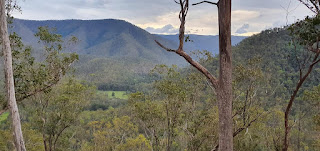
Looking down the track to Peaches crossing
at a homestead
|
My plan was to get as far as possible in case heavy rain caused trouble. In the end it took most of the day to get to Left Hand Hut. A New South Wales National Parks(NSWNPWS) hut. It's in pretty good nick and I sweep out some mouse droppings so the pack will be hung with all food in it. I did set up the tent inner inside to give me but protection. It rained pretty heavy this afternoon. Only for about 10 minutes but I'm still dry. I found a fresh mouse dropping on my cereal packet since I put it on the table so I expect
 |
| Last crossing of the river |
there's at least one. Hope to get a good sleep. Body battery gets depleted after a couple of long days and bad sleeps. The extra warmth of the valley disappears pretty quickly as the sun goes down. Time to snuggle down in my sleeping bag.
 |
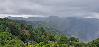
Looking up the Kuderang Brook Valley
|
 |
| The trail is a little overgrown |
 |
Left Hand Hut
|
 |
My set up. I put all food in the backpack and hung it.
|


